Donate
The Ripple Effects of Invasive Herbivore Removal: A Study on Santa Rosa Island’s Torrey Pines
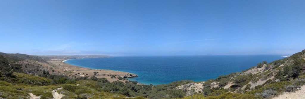
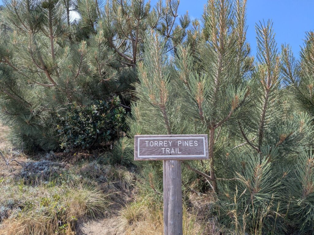
Santa Rosa Island, also known as Wima by the indigenous communities who originally inhabited it, is the second largest of the four islands in the Channel Islands National Park system. It supports some rare and endemic plant species, including the island subspecies of Torrey pine (Pinus torreyana subsp. insularis), which is almost entirely limited to the steep slopes in a single grove on the northeast side of the island. That grove was heavily affected by a wildfire that burned roughly a third of the island late in the spring of 2026.
The fire began on May 15, as I was completing a series of maps examining the growth of the Torrey pine grove and how it correlated with the removal of invasive herbivores, including sheep, goats, pigs, deer, and cows from Santa Rosa.
This was for a final project for an Introductory ArcGIS class offered by Santa Barbara City College. I was privileged to have the Garden’s support in taking this class, and was eager to immediately apply my knowledge to a topic I already knew well and cared about. Like many, I was shocked and dismayed as news of the fire spread, but I found hope in the project I had just finished.
Santa Rosa Island: From Early Ranches to National Park
Environmental pressures often intersect and stack, so even addressing only one issue, such as heavy grazing pressure from invasive ungulate species, means the affected native plant species has more resources available to reproduce or combat other issues like drought, flooding, or fire.
Santa Rosa has seen significant ecological change and disruption over the last few centuries. Indigenous communities that inhabited the land for thousands of years were forced to leave in the early 1800s, and private ranchers took it over soon after. They intentionally introduced ungulates, or hoofed animals that are mostly large herbivores. This included sheep, pigs, cows, and horses to manage the stock, as well as elk and deer for sport hunting. The animals were allowed a great deal of freedom to roam due to the absence of large carnivores on the island, and they ate and trampled vulnerable plants. No large herbivore species are native to Santa Rosa Island, so these plants lacked the natural defenses that many of their close relatives on the mainland have. Many plant species native to Santa Rosa Island declined rapidly as a result of this heavy grazing pressure, followed by the animals that rely on them.
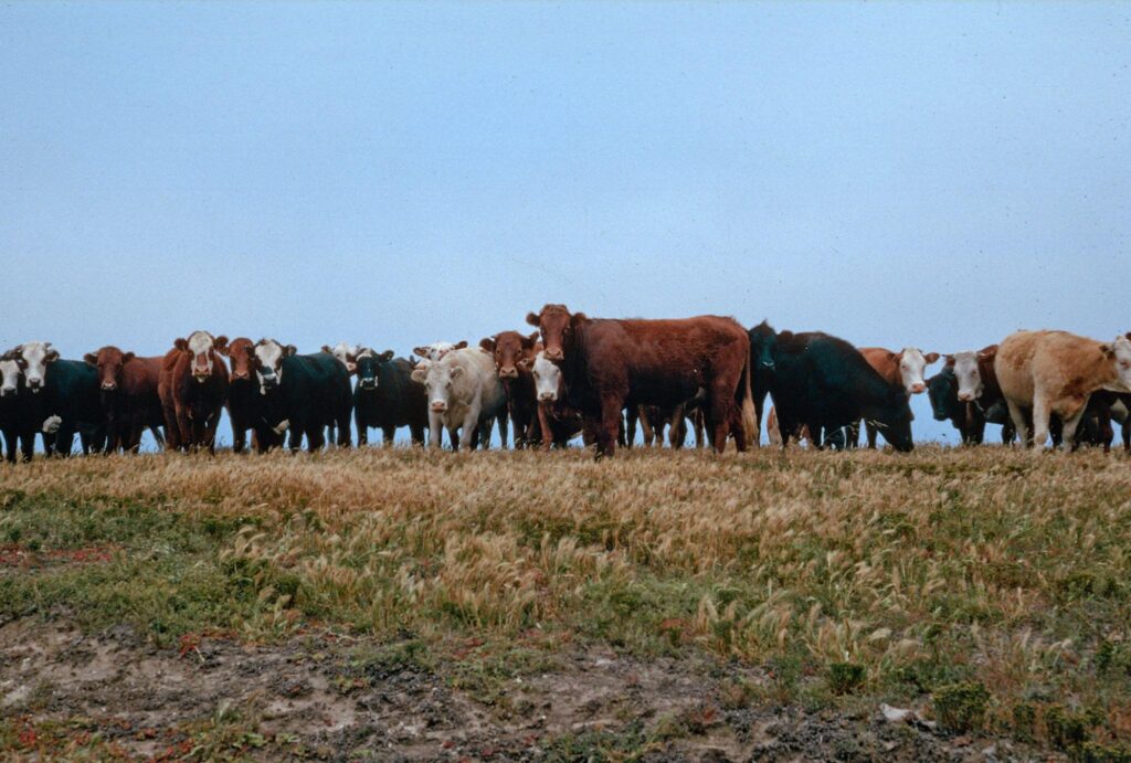
The National Park Service acquired Santa Rosa in 1980. In 1994, they began actively removing all non-native ungulates to protect the native plants and wildlife. By 2010, the ungulate population was down to 10 percent of what it was when they began. Today, none remain.
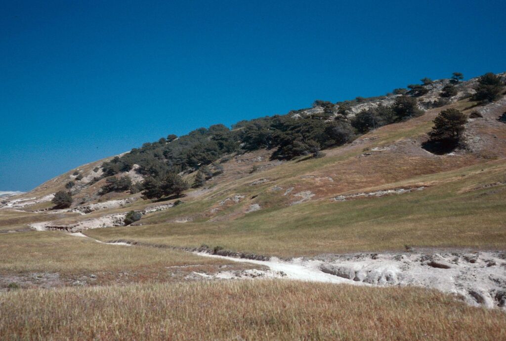
How did Grazing Animals Impact the Island’s Ecology?
Many island plant populations have rebounded since ungulate removal, including the Santa Rosa Island Torrey pines. However, I still had some questions I didn’t know the answer to. How many acres are now covered with Torrey pine forest since the removal project began? Is the grove expanding more in certain directions, or in certain types of terrain? Is the rate of that expansion changing at all, and if so, is it increasing or decreasing?
I wanted to answer these questions and characterize the Torrey pine grove’s expansion over the 31-year period from 1994 to 2025.
I created three overhead views of the Torrey pine grove in different time periods by georeferencing historic satellite images onto a modern satellite image from 2025. The two older images are from Google Earth historical imagery, and ESRI World Imagery provided the 2025 image (Figure 1). The years pictured here – 1994 color-coded as red, 2010 as blue, and 2025 as yellow – were chosen in order to create a halfway point to compare the growth rate during two different time periods.
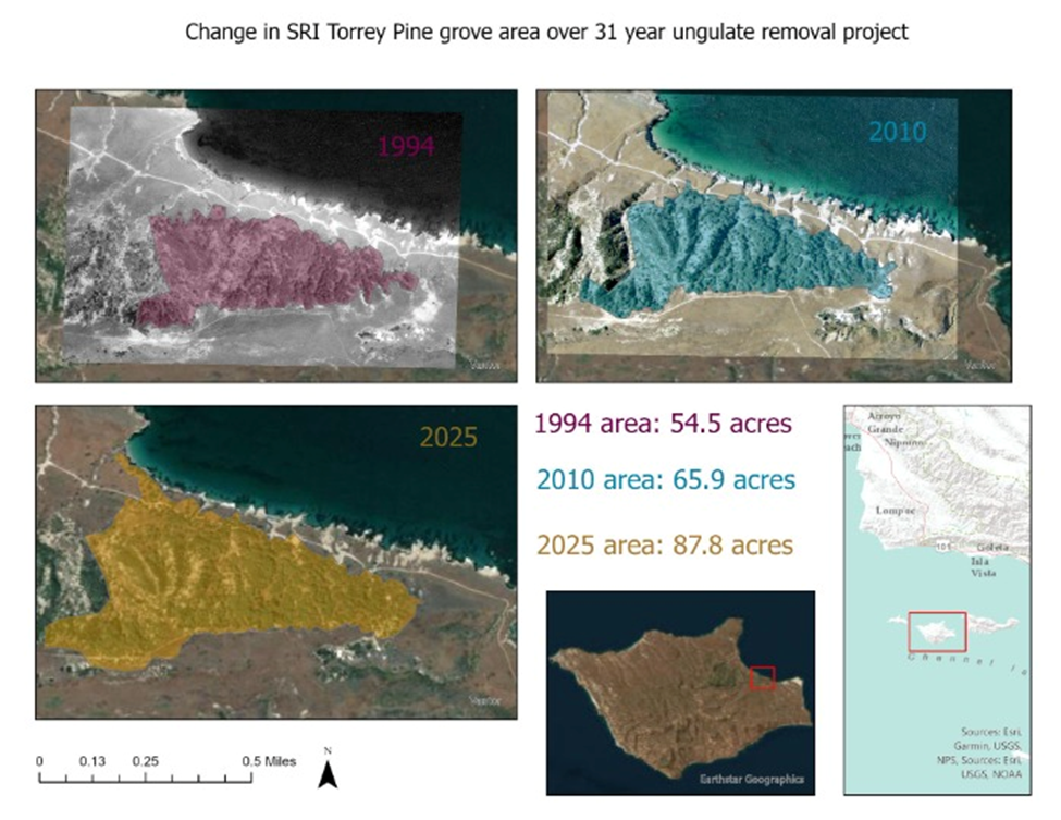
showing the extent of the grove in three years: prior to the removal of ungulates, the year removal was completed, and current day.
By 2010, almost all ungulates were gone from the island. Using that as the halfway point, we can compare changes in the groves between two periods: the first as the ungulate population started to decline, and the second as they declined from a very small population down to none. My next step was delineating the edge of the grove – one of the most challenging parts of this project! Very little in the natural world falls into an either-or, black-or-white dichotomy with clear lines, and the boundaries of a wild forest are not an exception. I chose boundaries by searching for areas with dense, contiguous clusters of trees, and excluded standalone trees or clusters that stood apart from the general mass of “grove” as viewed from above. After that, ArcGIS’s tools for analysis allowed me to calculate the area within the borders I had drawn.
Finding Hope Within the Data
These maps show that the change in the grove size during these two time periods was consistently positive: the grove was expanding during both periods (Figure 2). In 1994, the Torrey pine grove was approximately 54.5 acres. Sixteen years later, in 2010, the grove covered 65.9 acres. This was an overall increase of 11.4 acres, which is 21% of the original 54.5 acres from 1994. Fifteen years after that, in 2025, the grove covered 87.8 acres. This was an increase of 29.1 acres, which is 33% of the grove size from 2010 – a larger percentage of a larger area. Overall, the grove expanded from 54.5 acres to 87.8 acres from 1994 to 2025, an increase of 33.3 acres overall, or 61% of the size in 1994, when the removal project started. The grove expanded mostly to the north and east. The trees had previously only occupied the steep canyons and ridges on that northeastern slope, but now they are also growing in the flatter, grassy plains nearby.
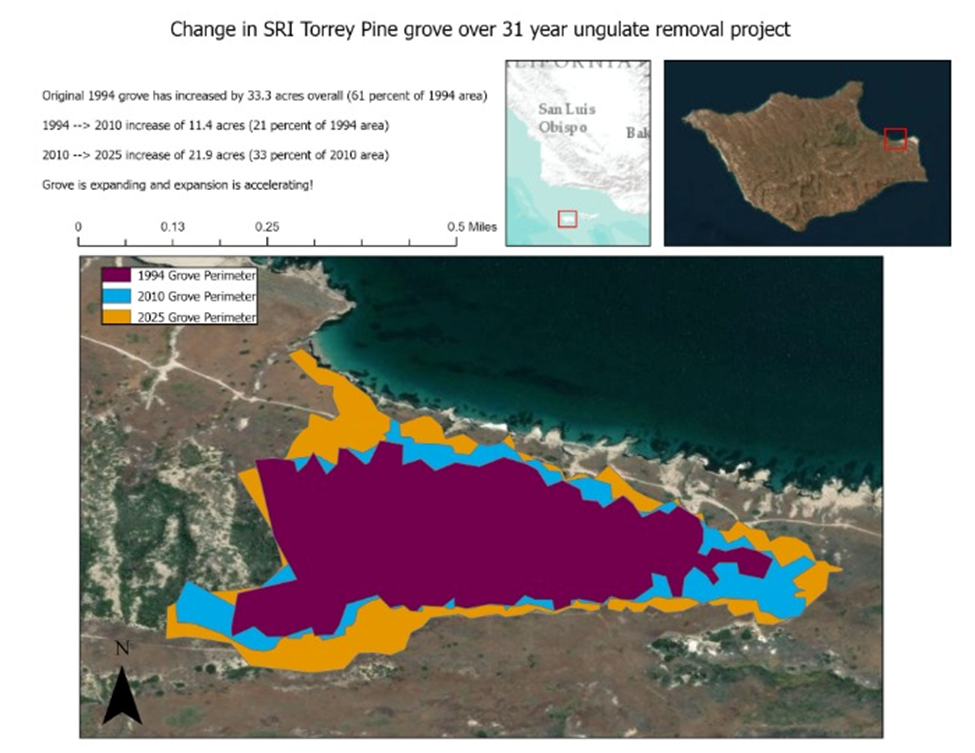
This was an overall increase of 11.4 acres, which is 21% of the original 54.5 acres from 1994.
Fifteen years after that, in 2025, the grove covered 87.8 acres. In 1994, the Torrey pine grove was approximately 54.5 acres.
Sixteen years later, in 2010, the grove covered 65.9 acres.
This was an overall increase of 11.4 acres, which is 21% of the original 54.5 acres from 1994.
Fifteen years after that, in 2025, the grove covered 87.8 acres
The first period, during which the Torrey pine grove expanded while still under some grazing from ungulates, had a smaller percentage of growth than the second period, which occurred while grazing pressure from ungulates dropped from 10% of the original amount to no pressure at all. Torrey pines not only expanded during that second period, but the grove’s growth accelerated as ungulate pressure eased further. Furthermore, the tendency for the grove to spread mostly into flatter, grassy terrain that would have originally been grazed by ungulates rather than to only spread further into the steep, mountainous terrain that makes up most of its current habitat implies that the removal of ungulates opened up new territory that was formerly unavailable. With so much more viable habitat now open around them, Torrey pines have better odds of recovering from other environmental pressures, including fire.
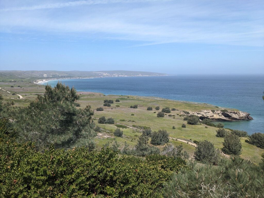
This project began as an amateur exercise in using ArcGIS on a subject I was already familiar with and cared about. Through the process of studying it further, I grew more passionate about the value of invasive species removal, more optimistic about the future success of the grove, and more appreciative of ArcGIS as a tool anyone can use to investigate the world.
Further reading:
Thomson, D. M., McEachern, A. K., Schultz, E. L., Niessen, K., Wilken, D., Chess, K., Cole, L. F., Oliver, R. Y., Phillips, J. D., & Tucker, A. (2022). Diverse native island flora shows rapid initial passive recovery after exotic herbivore removal on Santa Rosa Island, California. Biological Invasions, 24(6), 1635–1649. https://doi.org/10.1007/s10530-022-02735-4
https://www.nps.gov/chis/learn/historyculture/santarosaisland.htm

In the Nick of Time: Serendipitous Seed Collection During Fire Season
The Science Behind It All
Putting Pollinators First Through Art: A New Way to Design Gardens

What the Torrey Pines Are Trying to Teach Us