Onsite Weather Station and Live Fuel Moisture Sampling
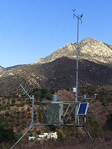
Onsite Weather Station (RAWS):
Remote Automatic Weather Stations (RAWS) are used throughout the country to monitor weather in remote locations for both fire protection and weather forecasting. Santa Barbara Botanic Garden maintains a RAWS site on its grounds (visible from the Porter Trail).
Weather data is transmitted hourly to the National Interagency Fire Center in Boise, Idaho, and used by our local National Weather Service in Oxnard to make accurate weather forecasts.
View the most recent data from the Garden’s weather station
Live Fuel Moisture Sampling:
Live Fuel Moisture (LFM) is one measure of fire risk that agencies use in planning how to allocate their resources. LFM is simply the amount of moisture contained in fine fuels (living foliage and twigs less than 1/8 inch diameter) expressed as a percent of the dry weight of that fuel.
Fire agencies typically consider 60% to be a critical moisture level where fires can become catastrophic. Plants have high LFM in the winter and early spring, when rainfall is plentiful and the weather is cooler. In summer and fall, LFM drops as plants transpire water and soils dry out. The cycle repeats itself annually, with plants again increasing in LFM (and decreasing in flammability) following the first fall rains.
Santa Barbara Botanic Garden has collaborated with the University of California Cooperative Extension since 2013 to measure LFM in vegetation at several sites near the Garden, including along Painted Cave Road, at the top of Tunnel Road, and at St. Mary’s Seminary on Las Canoas Road. We collect from two species: chamise (Adenostoma fasiculatum) and bigpod ceanothus (Ceanothus megacarpus).
2023 & 2024 Live Fuel Moisture Trends
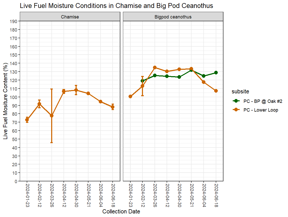
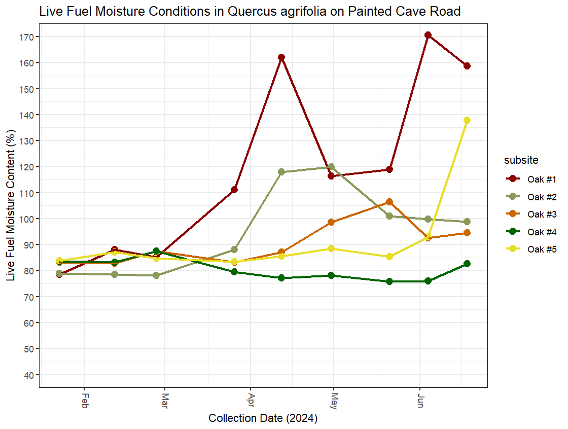
These charts show the LFM trends in 2023 and into 2024 thus far along Painted Cave Road. The first figure depicts Chamise and Bigpod Ceanothus LFM content on Painted Cave Road, while the second graph shows us the LFM content in several Coast Live Oak trees located along Painted Cave Road. These figures will be updated regularly as more data is collected. Click the charts to see a larger version.
 Donate